Tuesday, February 19, 2013

Tuesday 2/19

Temperature: 7°F (Wind Chill -14°F)
Humidity: 52%
Pressure: 1017.3 mb
Wind Speed: NW 15 mph Gusts up to 24 mph

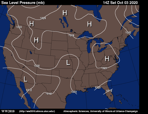
Yesterday evening the wind direction changed from a East or Southeast wind to a straight NW wind. This wind direction change brought much colder air from the North than the air from the South. As a result, the temperature has dropped nearly 30° from the high yesterday. Also, it's worth noting that a midlatitude cyclone is formulating out West, and will need to be monitored throughout the week. As of right now, this storm (Winter Storm Q) is predicted to drop 5-8 inches of snow on Eau Claire around Thursday or Friday. On the map below, there is a stationary front along the East side of the Rocky Mountains that will funnel cold Arctic air towards the East, and towards Wisconsin. Bundle up, and get your shovels ready.

US: Current Weather

Monday, February 18, 2013

Monday 2/18

Temperature: 35°F (High 34°F)
Humidity: 72%
Pressure: 999.5 mb
Wind Speed: W 6 mph

The current conditions are turning out to be a little different than the forecast. As you can see, we have already surpassed the forecasted high temperature, and there was supposed to be a 90% chance of snow, which we have not seen yet. Based on the doppler radar, I would say that there is a better chance of not getting any snow today in Western Wisconsin.

US: Doppler RadarUS: Current Weather

We are in an elongated area of low pressure (trough) today, so we will be seeing some more cloud formations later this evening.

Saturday, February 16, 2013

Saturday 2/16

Temperature: -1°F (Low -18°F)
Humidity: 79%
Pressure: 1023.2 mb
Wind Speed: Calm

The past few days have been cold here in Eau Claire. We've seen consistent highs of about 17°F, and it is likely going to stay that way through the weekend. If we take a look at the Current Weather map from Weather.com, we can see that there are two warm fronts to the West of us that are likely to come our direction. This means by early next week we might see some warmer temperatures.

US: Current Weather

Wednesday, February 13, 2013

Wednesday 2/13

Temperature: 31°F (High 35°F)
Humidity: 69%
Pressure: 1006.1 mb
Wind Speed: W 6 mph

For a mid-February day in Wisconsin, it is gorgeous outside! Light wind, plenty of sunshine, and warm temperatures (the average mean temperature for February 13th is 19°F). The bad news, is that there appears to a cold front headed our way, which will bring some cold polar air with it. We can expect the temperatures to drop a little bit towards the weekend.

US: Current Weather

Tuesday, February 12, 2013

Tuesday 2/12

Temperature: 26°F (High 31°F)
Humidity: 71%
Pressure: 1014.6 mb
Wind Speed: SW 14 mph

Today there is kind of an interesting situation; the wind in Eau Claire is coming from the Southwest, however it's not unusually warm. Normally, any wind coming from the South is typically warm air, but in today's case, it is not any warmer than the air we have gotten the past few days. If we take a look at the jet stream today, we can see that the jet stream is bringing this air from the Southwest, but all this air originated in polar regions, so it is still cold.

Tuesday US Jet Stream

Today we have mostly sunny skies in Eau Claire, which is always leads to some evaporation and possible cloud formation, but for the rest of the day and into tonight temperatures will most likely remain in the mid-twenties.

Monday, February 11, 2013

Monday 2/11

Temperature: 27°F (High 30°F)
Humidity: 75%
Pressure: 1006.4 mb
Wind Speed: W 14 mph, Gusts up to 26 mph

Well the pressure is lower than it has been the past week or so, which explains the cloudy conditions and the relatively high winds. If we take a look at the Sea Level Pressure map for today, we can see that Eau Claire and most of the Great Lakes area are in a large low pressure system. Also, we can see that the isobars are pretty close together over Eau Claire, which is why we are having fairly strong winds blowing towards the center of the low pressure system.


It seems as though that there is nothing but high pressure systems forming to the West of Eau Claire, so we can expect to see the sun a little bit more throughout the next couple of days. However, don't be surprised if we continue to get some dustings of snow, those Alberta Clipper systems are not finished quite yet.

Thursday, February 7, 2013

Thursday 2/7

Temperature: 25°F (Low 11°F)
Humidity: 81%
Pressure: 1022.5 mb
Wind Speed: N 8 mph

Today was a pretty crummy day. It was overcast all day, with fog in the morning and freezing mist at night. The Jet Stream was in a very geostrophic position, blowing straight West to East for the most part. This would explain the lack of strong winds and a relatively boring day of weather.

Thursday US Jet Stream